
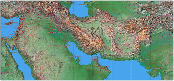
Photoshop JPEG Relief map and Illustrator EPS vector map Middle East #321
Mountain High Relief Map package of Photoshop JPEG and Illustrator EPS map of the Middle East. Complete territory from Egypt to India, 31º East to 76º East, 20º North to 41º North is a high quality fully editable geopolitical relief and vector map in geographical projection and is supplied with a comprehensive set of layers including rivers, roads, towns, town names, provincial and national borders.
JPEG Relief maps and EPS Vector maps can be easily and quickly loaded into desktop design, publishing, presentation apps for the highest quality geographical representation. At 100 dpi this maps measures 54 X 25 inches, 5,398 X 2,517 pixels and has a 39 MB decompressed file size. Map resolution is 1700 meters per pixel.